When early settlers first came to Tennessee, they were faced with many rivers to cross on their journey. At first, they followed animal paths and Indian trails to find places that were the safest places to cross. As the population increased, local settlers started ferries to help travelers to cross they river and to supplement their farm income. Because rain could cause increased water flow making crossing the river more difficult and even dangerous, passengers would have to wait until the flooding subsided to cross the river. For this reason, ferries were also local social centers in rural areas. Here was a chance to hear the news from a family passing through the area.
 | ||||
| Early Statute |
In 1804 County Courts were given authority to establish ferries and to set the toll rates. Ferries were free on election day.
 |
| Read more: here |
Because ferries were used to cross river, ferry points were key assets during the war. An army was vulnerable during crossings because they were out in the open with little defense.
 |
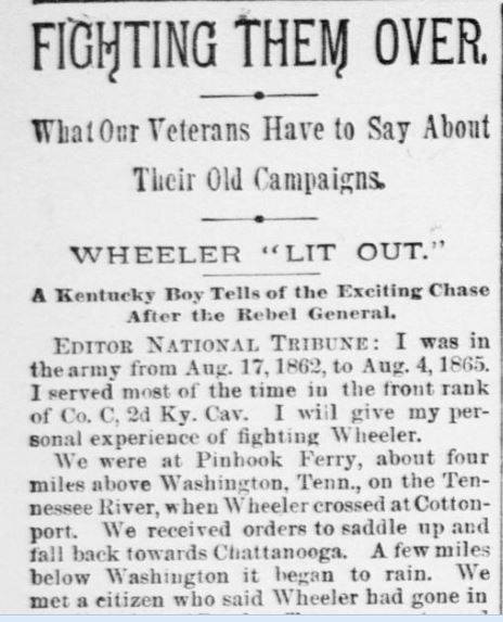
| Article about Pinhook Ferry from The National Tribune. — 2 August 1894 |
As communities grew into towns and cities, citizens would build a bridge. Sometimes the bridge was built by the local government and sometimes they were built by individuals. The county bridges offered easy access across the river, but they were far from dependable routes for travelers. As bridges were built, travelers were less and less dependent on ferries. At one time, there were hundreds of ferries in East Tennessee, but now they are a memory. It's a memory that I don't think we should forget.
 |
| East Tennessee Ferry Locations |
East Tennessee Ferry Map Link to large map.
Many thanks to all who have contributed to this map, especially my friends on the You know you're from Knoxville if: and the TNGenweb Project facebook groups.

I am kin to the Ellis family who ran the Ellis Ferry.
ReplyDelete